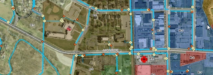
What is GIS?
GIS stands for Geographic Information System, which is a computer-based system that captures, stores, analyzes, manages, and presents data that is spatially referenced to locations on Earth.
What is GIS used for in the City?
GIS software links geographic data with descriptive information, creating interactive maps and allowing for complex spatial analysis to inform decision-making in fields such as city planning, environmental management, and emergency response.
GIS resides in the Division of Engineering. It is responsible for maintaining all types of data and mapping within the Department of Public Service. The types of data and maps include but are not limited to:
- Water Distribution Network
- Sanitary Network
- Stormwater Network
- Roadway Network
- Parks & Forestry
- Zoning
The GIS Coordinator is responsible all City maps, digital data, and provides technology solutions the Department of Public Service.
Terry Adams
GIS Manager & City Data Manager
Suite 101
6730 Monroe St.
Sylvania OH 43560
P: 419-885-8733 x50726
E-Mail: tadams@cityofsylvania.com
Hours: Monday through Friday, 8:00 a.m. to 4:30 p.m.


